The Nashwaak Watershed

Make a difference, get involved.

  • Email
  • Facebook
  • Instagram
  • Twitter
  • YouTube
  • Home
  • About Us
    • About the Nashwaak Watershed
    • Membership
    • Partners and Supporters
    • Staff and Board of Directors
      • Board Nominations
  • News
  • Projects
    • Aquatic Connectivity
    • Cyanobacteria
    • Economic and Resource Development
    • Education
    • The Nashwaak Greenway
    • Riverbank Stabilization
    • Salmon Protection and Monitoring
    • Water Classification
    • Watershed Monitoring
  • Resources
    • Action Plan
    • Explore the Nashwaak
    • Newsletter
    • Resources for Educators
    • Reports and Management Plans
    • State of the Nashwaak Watershed Report
  • Events
  • Contact
    • Monthly E-blast

Seeking Volunteer Help on the Nashwaak

May 7, 2014

Photo: Michiko Nishijima

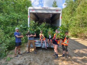
As in past years, we are seeking volunteers to help out at the Rotary Fish Traps (smelt wheels) on the Nashwaak this spring. This is an interesting experience and well worth your time.

Below is a description of what you can expect, as well as the dates for which volunteers are needed. Please e-mail Peter Salonius or telephone him at (506) 459-6663 to let him know on which dates you might be available. NOTE: You may not be needed on the day you have chosen if the operation is not going on due to high water or lack of fish in the days previous.

Saturday, May 10 —-
Sunday, May 11 —-
Saturday, May 17 —
Sunday, May 18 —
MONDAY, May 19 —
Saturday, May 24 —
Sunday, May 25 –

++++++++++++++++++++++++++++++++++++++++++++++

The routine is that the DFO tech — who will be on duty for your morning — will contact you by phone a day or so before

to set a time and place to meet. The tech will often pick you up at your residence on the way out to the smolt wheels / that are just downstream from Durham Bridge/and drop you back at your residence when the work is completed.

The wheel(s) look like cement mixers with the big end facing upstream — the current makes the wheel rotate and downstream migrating fish are gently directed by the wheel’s rotation into a holding well at the downstream end of the unit.

You will travel by motor boat upriver to the smolt wheel that is guy-wired in the main current, and tie up the boat to the deck which is like a floating dock. The tech will do most of the operation (clearing debris from the wheel and fish well, netting the fish and depositing them in buckets in the boat). The tech will need you to tally the salmon smolts as WILD or HATCHERY ORIGIN in groups of five, as well as marking down other species and their sizes —- all on waterproof paper in a log book.

Once back on shore the retained fish in buckets will be anesthetized, measured, weighed and have a scale sample removed for later analysis to determine how many years they have been in the river since hatching from the egg — here again you will be making entries in the log book and marking lengths and weights on sample envelopes into which the glass slides with the scales are deposited. A certain number of the fish will have a small part of their fleshy adipose fin removed / clipped off— which is an operation requiring both you and the tech.

At the end of the morning, the clipped fish will be taken several kilometers upstream and placed back in the river. The proportion of these fish that are recaptured on subsequent days will indicate how much of the total population is being captured by the wheel(s) so that the total number of juveniles migrating toward the ocean can be estimated at the end of the season.

DFO operates an adult fish counting fence in the same location during the summer — so that the numbers of salmon returning from the ocean can be compared to the smolt numbers that migrated to the ocean /// this measure gives an indication of marine survival.

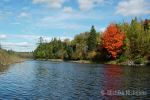
The Nashwaak is used as the INDEX river for all salmon streams downstream fro the Mactaquac dam.


Filed Under: News & Events

Stay in-touch!

Donate Now

Recent News

Lunch & Learn: Flood Mitigation and Community Resilience Series

February 8, 2021

NWAI 25th Anniversary and Annual General Meeting Videos

November 27, 2020

“A cheaper way to fight flooding”: Daily Gleaner, October 2, 2020

October 9, 2020

East Ryan Brook Fish Ladder Installation

September 15, 2020

Upcoming Events

  1. Lunch & Learn: The Link Between Natural Infrastructure & Flood Attenuation

    March 10 @ 12:00 pm - 1:00 pm

View All Events

Upcoming Events

  1. Lunch & Learn: The Link Between Natural Infrastructure & Flood Attenuation

    March 10 @ 12:00 pm - 1:00 pm

View All Events

NWAI on Twitter

This is the river at McLaggan Bridge. In 2020 part of this rocky cliff dropped into the river. It makes one think about "deep" time and the geological processes and glacial action that make rivers. https://t.co/GO6z2LL836

- 1 day ago

Another success for #eaunbwater #ConservationMatters https://t.co/qZbj9T3MRy

- 1 day ago

We're so pleased to team up with you on this one @AtlanticDucks! https://t.co/t7pROGUoqd

- 1 day ago

@NatureNB: March 5th is the Day of Unplugging. What better way to end March Break, than by turning off your devices and getting outside? Get out for a walk in a local park or green space, and really take the time to be a part of nature and appreciate quality time with loved ones. šŸŒ²šŸ’š https://t.co/B1vJYwiQQL

- 1 day ago

This morning the Nashwaak Watershed Association started our Spring Break-up data gathering for GNB's River Watch Program. From early March into early April we will monitor conditions on the Nashwaak River at 9+ sites, twice weekly. See the river at Giant's Glen Rd. https://t.co/wOJ8AWHv2N

- 4 days ago

Follow @NashwaakWater

NWAI on Facebook

Nashwaak Watershed Association Inc.

2 days ago

Nashwaak Watershed Association Inc.
Each week as we gather data for the River Watch Program, we will introduce you to a new place on the watershed. This is MacLaggan Bridge (between Nashwaak Bridge and Stanley). In 2020 a section of the rocky cliff in this photo broke off and fell into the river. It is hard to tell if more erosion has happened since or if the snow is falling from the upper ledge. It makes one think about "deep time" and the geological and glacial processes that created the Nashwaak in the first place. ... See MoreSee Less

Photo

View on Facebook
· Share

Share on Facebook Share on Twitter Share on Linked In Share by Email

Contact Us

Mail:
Nashwaak Watershed Association Inc.
P.O. Box 314, Station ā€œAā€
Fredericton, NB
E3B 4Y2

Office:
181 Westmorland Street
Fredericton, NB
E3B 3L6
Google Map

Phone: 506 261-4664
Email

Copyright © 2021 Nashwaak Watershed Association

Site developed for the Genesis Framework and WordPress by Kent Fackenthall · Log in