July 19, 2022 Daily Gleaner article by John Chilibeck
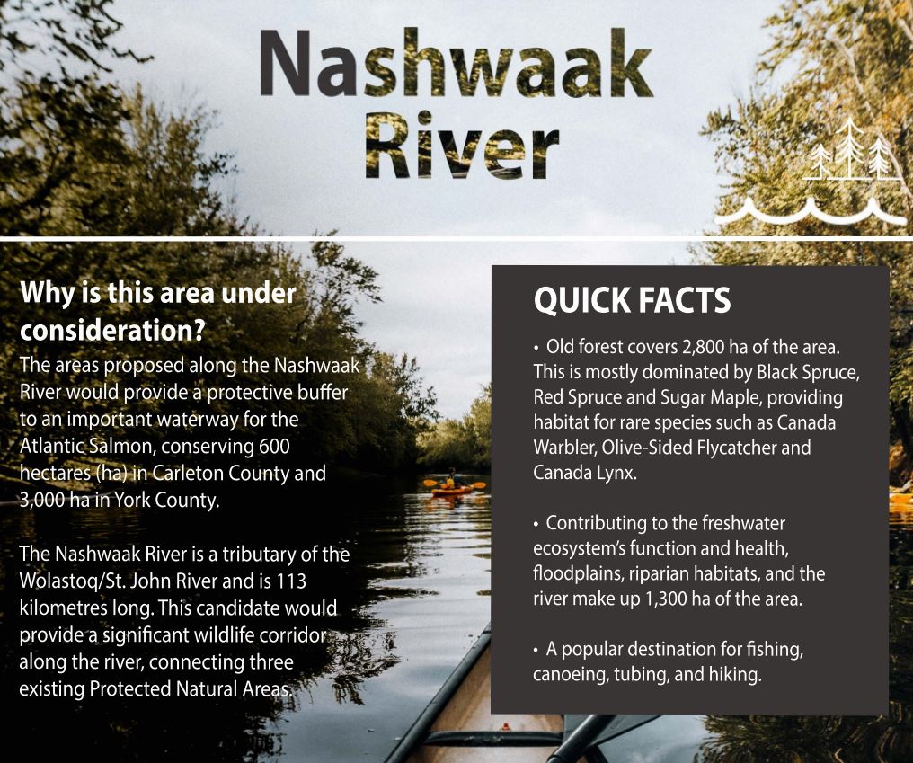
A newly conserved area along the Nashwaak River in central New Brunswick has one large gaping hole, says the group that helped nominate the area as part of the provincial government’s goal to double its permanently protected land and waterways.
Ian Lodge, a board director of the Nashwaak Watershed Association, had recommended the province conserve several tracts of old growth forest near the proposed Sisson Mine site. Instead, the province announced last week it would protect Crown Land from industrial development and forestry south of the proposed mine site, along about 50 kilometres of the Nashwaak, a tributary of the St. John, or Wolastoq, River.
“I didn’t expect all the area that I nominated to be selected for conservation” Lodge said in an interview Monday. “It was kind of a shoot-high-and-expect-low exercise. But I’m pretty happy that 3,000 hectares in the Upper Nashwaak have been selected, which is a large area. It covers the river from Nashwaak Lake to the Stanley area. That’s awesome. And I hope they’ll expand it.”
When the province launched its New Brunswick Nature Legacy Information Hub in November 2020, people were invited to nominate specific areas and share their reasons why they should be preserved. Mike Holland, the minister responsible for natural resources, set a goal of increasing permanently protected areas from 4.6 per cent to 10 per cent of New Brunswick’s land and freshwater.
Lodge, who also worked for the Nature Trust of New Brunswick at the time, know that Crown land along the Nashwaak was a prime candidate. Using geographic information system mapping, he put together a list of the most important old forest, riparian and wetland habitat that’s home to several species at risk.
He eventually submitted a list of 2,000 hectares he thought would be best to conserve. The province, however, included fewer than 500 of these hectares, picking different parcels along the river’s banks.
The rural area an hour’s drive north of Fredericton has rolling hills, steep banks and a shallow, rocky-bottom river where endangered Atlantic Salmon spawn. The trees nestled on the hill include sugar maples, hemlock, black spruce and red spruce, idea of rare species such as the Canada Warbler, Olive-Sided Flycatcher and Canada Lynx. “It’s beautiful in there” Lodge said. “Very few people, very few camps, and a lot of forestry.”
A spokesperson for the provincial government pointed out it had only announced the first 100,000 hectares associated with The Nature Legacy initiative. By March 31, 2023 about another 300,000 hectares of conserved areas will be selected for final protection.
The Upper Nashwaak River Valley (from Nashwaak Lake to the Stanly area) is one of the featured conserved areas of the NB Nature Legacy. In addition to the Nashwaak River, the Headwaters of the Penniac Stream are also featured. The NWAI is deeply committed to increasing protected and conserved Crown land in the watershed. On July 14th, the province announced that the first 84 Nature Legacy protected areas were established. The first 84 areas will protect about 90,000 hectares and more than 10,000 hectares will soon be added for a total of more than 100,000 and will provide important habitat to conserve the province’s biodiversity.